DoHistoryWho Was Martha Ballard?Maps and PicturesMap of Hallowell site maptech helpabout sitesearch

Map of the Parishes of Hallowell / Ephraim Ballard 1794

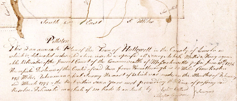
Detail: Map Legend

The Legend below reads:

This is an accurate Plan of the Town of Hallowell in the County of Lincoln on which is delineated or described & here inserted or specified all & every Article Matter & Thing agreeable to a Resolve of the General Court of the Commonwealth of Massachusetts passed June 10th 1794.
The reputed Distance of the Center of said Town from Pownalborough is 20 Miles, from Boston 195 Miles, Taken on an a [trial] survey the most of which was made in the Months of February and March 1795 & the Rest within seven years next preceding the Time of passing said Resolve. Delineated on a Scale of 800 Rods to an Inch by

  Ephm Ballard } Surveyors
  Silvester G. Moore

home your interests who was Martha? Martha's diary book film doing history archive on your own
maps & pictures | Martha Ballard timeline | walking tour