
|
|
|
|
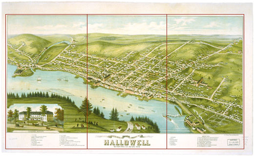
Engraved many years after Martha Ballard's time, Ruger's illustration nevertheless shows how Hallowell's hills rise from the Kennebec River valley, leaving almost no flat ground. By 1878, farmers had cleared even the steepest slopes. In Martha's day, there would have been many more trees and fewer buildings. Commercial ships ply the Kennebec in this engraving as they had a century earlier, but for the appearance of a steamboat in the lower right. Notice also the buildings clustered along the riverbank, despite frequent seasonal floods. |
 |
|
||||||||||||||||||